 – Chefchaouen and hiking Jebel El-Kelaa in the Rif Mountains")
After two nights in Tangier I was on the move to Chefchaouen, a town in the Rif Mountains famed for its picturesque blue-washed medina. I arrived shortly after 3pm following a 2-hour Grand Taxi ride. A shared taxi like this is significantly quicker than the bus and, at 70 dirham, not a great deal more in cost. Not everyone in the taxi, however, survived the journey! At halfway just outside Tétouan we arrived at a police checkpoint. More often than not you get waved through these but this time everyone’s passports and identification were checked. What then followed was somebody being removed from the taxi in handcuffs! All very strange and not something I – or indeed anyone else in the taxi – was expecting to happen. I was assured this wasn’t in any way a normal occurrence!


On arrival in Chefchaouen we were dropped just outside the medina. My accommodation was within walking distance but I still needed to find it – easier said than done in the narrow streets of a Moroccan medina and two days before I belatedly discovered the wonders of the maps.me app! I reached for my Lonely Planet guide but frustratingly my location was just off the map and the act of getting the book out only served to draw unwanted attention. At this point a man approached to ask where I was going. When I said the Dar Baraka hostel he offered to show me the way. Whilst I could have easily enough figured it out for myself my motivation to do so was waning, especially as it was now starting to rain. This provided a quick solution even if I would have to pay him something.


So off we walked as the man welcomed me to what he described as the marijuana capital of the world! He then spent the entirety of the walk trying to sell me some as he took me the long way round in a tactic to extract more of my change – the exact amount we ended up haggling about. Soon enough, though, I had arrived and was in the warm and dry.
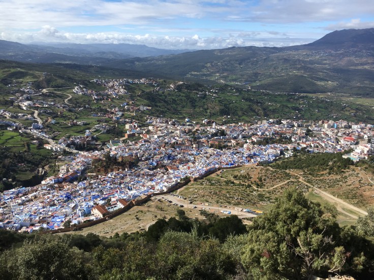
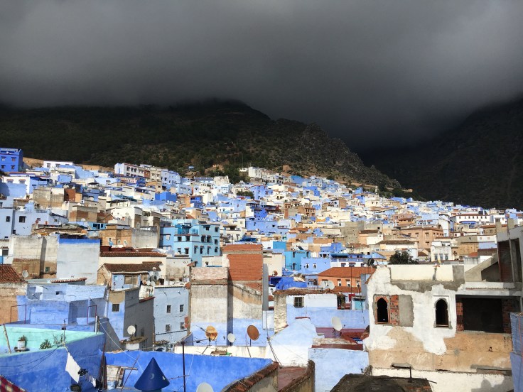 I found Dar Baraka, a hostel run by an expat English woman, a nice place to stay. The staff were friendly, the bunk beds sturdy and it was sufficiently intimate to make it a socialable place to meet other travellers. It also came with a great rooftop terrace view (pictured above on my arrival) although I didn’t take as much advantage as I would have liked as the temperature was still fairly cool. As well as the presence of faded Union Jack cushions the hostel was also noteworthy for its filling ‘Sultan’s Porridge’ breakfast. Although it cost extra (25 dirham) it certainly sorted me out for a day of walking around.
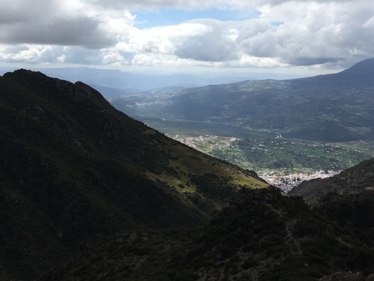
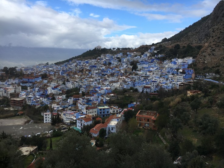 To start my first full day I walked up to the Spanish mosque which provided some great views looking back at Chefchaouen, framed against the backdrop of the Rif Mountains. I then hung out for a while on a cafe terrace reading and chilling before heading down to the main square.
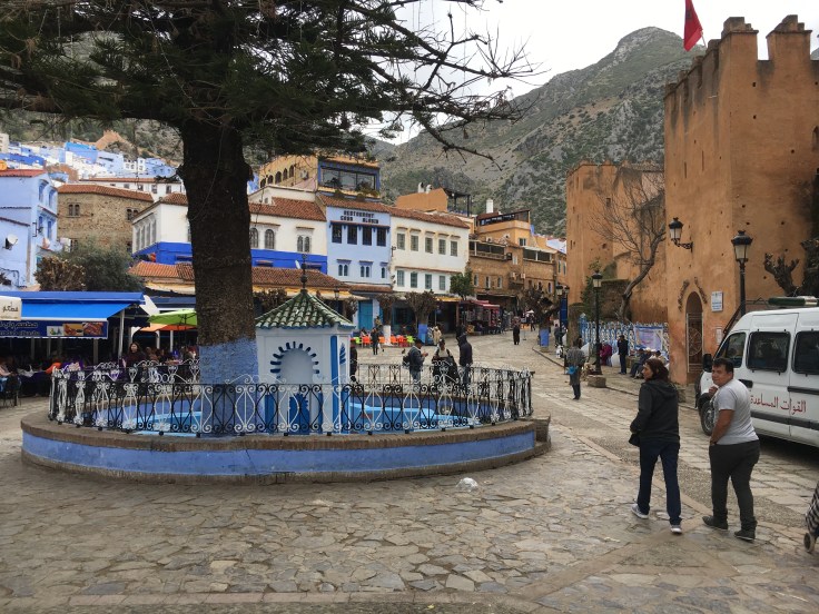 With some light rain about I grabbed a mint tea before parting with 60 dirham to enter the Kasbah. Chefchaouen Kasbah is a restored walled fortress containing a garden and small ethnographic museum. Naturally, it offered some more great photo angles of the town.
 I really liked the vibe in Chefchaouen and its blue medina was picture perfect. Being a small mountain town definitely contributed to its relative tranquility and, with the exception of weed-sellers, I experienced a lot less hassle than in other larger Moroccan cities.


I had plans for a more active second day given I was within touching distance of the mountains. The hikes promoted by the hostel were to a scenic waterfall and/or rock formation called ‘Gods Bridge’ near Akchour, about 40 minutes away by taxi. But I had something else in mind.
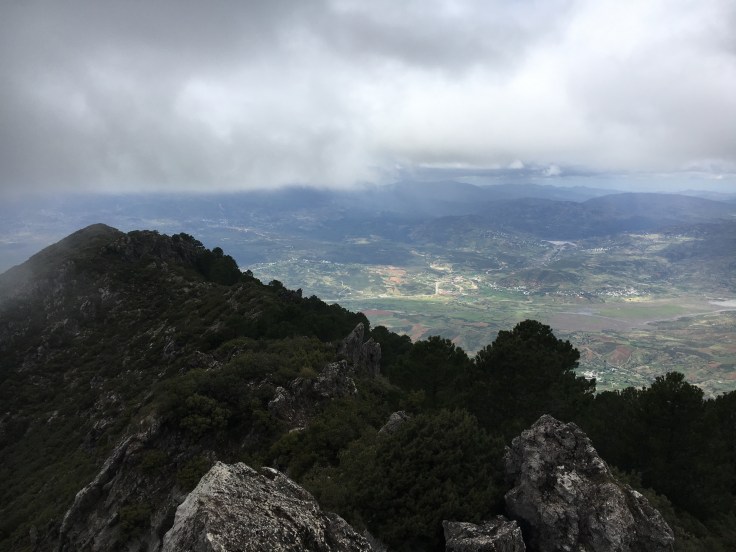
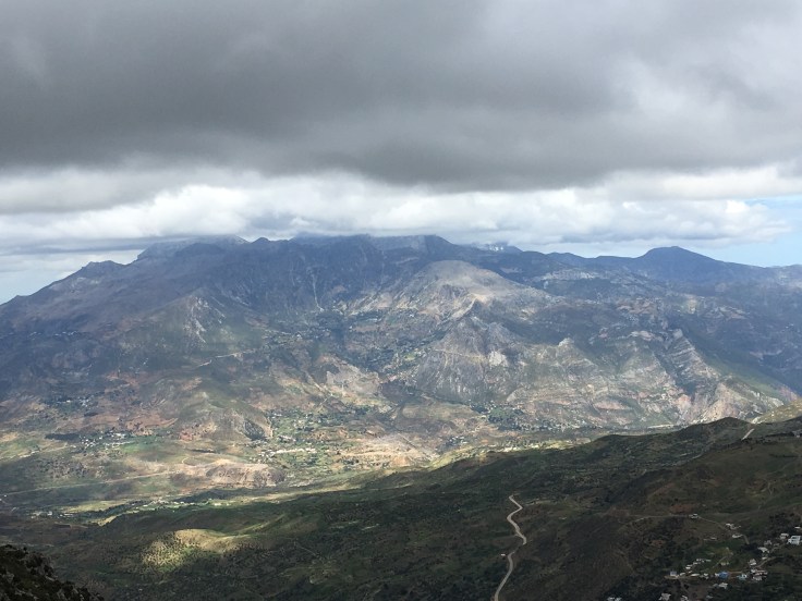
 My Lonely Planet guidebook set out a walk to the summit of Jebel El-Kelaa, a peak standing 1,616m tall to the north-east of Chefchaouen that would afford some great views of the Rif. Fuelled by my ‘Sultan’s Porridge’ and stocked up on supplies – well, water and a hunk of bread – I ventured off at 10am. I was soon above the medina walls and on the trail, a 4WD track that marks the start of a 5-day 56km trek from Chefchaouen to Bab Taza. For the first hour, though, I saw no-one – it was a fairly serious hike requiring good fitness and not one most tourists think to do in spite of its accessibility from the town.
 After an hour I caught up with a Dutch couple. They seemed pleased to see me as they hadn’t seen anyone else either, a situation that makes one question whether hiking the mountain really was such a good idea. We walked together for the next hour until we reached Ain Tissimlane, a hamlet consisting of about 3 houses. We were invited into one of them to have a tea and it turned out there was a marijuana-growing operation going on out the back! Given the region perhaps this was not such a surprise; indeed, hash farm tours educating in how it is produced are commonly offered in the Chefchaouen area.
 The Dutch couple turned back but I continued on, soon running into an English couple who had overtaken whilst I was having my tea. This was fortunate as they had more of an idea where they were going, explained by the fact they had maps.me installed on their phone. I was pretty stunned by how detailed and accurate this mapping tool was up in the mountains, especially as Google Maps was showing me nothing.
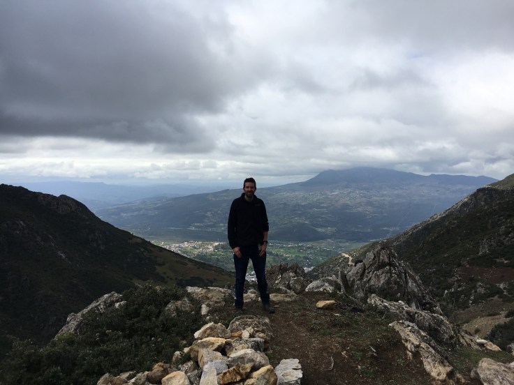
 Maps.me was practically Ordnance Survey standard – well, minus the contour lines – in its detailing of paths, showing a clear route to the summit with a definitive tack off to the left just before reaching it. This meant ascending to the top of a visible pass before undertaking the final climb. This last bit did require a bit of me making my own way as I had drifted off the path slightly. But with the summit now in reach it was a case of just needing to go up! With a bit of scrambling I was on the summit and the views were great.
 To be clear, I don’t want to come across as being blasé about map-reading. When I go mountain walking in the UK I always carry an Ordnance Survey map and compass; the stories you hear of people not doing so, getting into trouble and then having to call out mountain rescue, prove how important they are. If it had been straightforward to get hold of a decent map for today I would have bought one. Going without I justified on the grounds I was walking up a 4WD track for most of the day and the last part would be a relatively short section. As long as the weather stayed clear I would be fine.
 After summiting, I made my way back down at a more leisurely pace as I was feeling quite tired by now. Despite it being a nice temperature for walking and not sunny the whole way through, I had still taken quite a lot of sun and was feeling dehydrated. Fortunately, the mountain water was drinkable and I took advantage of a spring halfway down for rehydrating.
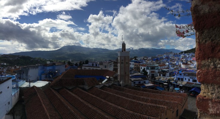
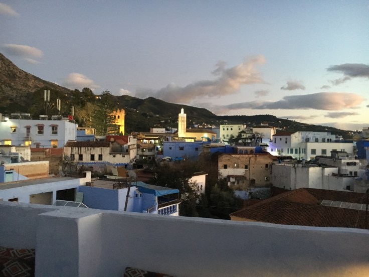 By the time I got back to the hostel I was pretty knackered but within the hour I headed out for dinner with a fellow traveller to Cafe Clock. The outdoor terrace (sundown view pictured above) had a great ambience as I tucked into a tasty Chicken Rfissa dish – a nice change-up from my tagine staple. It was then back to the hostel where for once in a dorm room I slept very well!

Leave a comment